
Vieques
Historical Overview
Vieques, an island municipality situated approximately eight miles east of Puerto Rico's main island, was formally established as a municipality in 1852 after a period of contested colonial claims between Spain, France, and Britain. Originally under the jurisdiction of Humacao on the main island, Vieques developed around the town of Isabel II and became notable for its sugar economy and the strategic Fortín Conde de Mirasol, the last Spanish fort built in the Americas. Parish records beginning in 1844 at the Inmaculada Concepción parish are the earliest genealogical sources for island families; researchers should also check Humacao's earlier registers when tracing family lines predating the Vieques parish establishment. Twentieth-century records require awareness of the U.S. Navy's presence on the island from 1941 to 2003, which displaced residents and created migration patterns toward the Puerto Rico mainland, St. Thomas, and the continental United States.
Coat of Arms

Image: Wikimedia Commons (CC BY-SA 4.0)
The coat of arms features blue and white horizontal waves symbolizing the sea surrounding the island. A green rhombus at the center contains a gold castle, representing the island landmass and the historic Fortín Conde de Mirasol. A naval crown surmounts the shield, emphasizing Vieques's maritime identity and its history as a Spanish naval station. The overall design reflects the island's geographic isolation, colonial military heritage, and dependence on the sea.
Barrios
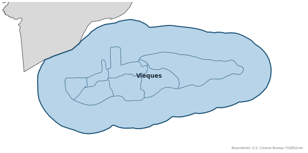
Genealogical records often identify individuals by barrio. Vieques has 6 barrios:
Daughter Municipalities
The following municipalities separated from Vieques. Residents recorded events before their founding year in Vieques's parish:
Neighboring Municipalities
Also check records in neighboring municipalities:
Historical Maps
Historical maps help identify barrios, boundaries, and communities as they existed in the past. Maps from the 18th and 19th centuries are preferred.
Vieques (2026)
Genealogy Toolkit
Diocesan Archive
Diocese: Diocese of Fajardo-Humacao
For sacramental records not available digitally, contact the diocesan archive directly.
Diocese WebsiteDigital Archives
- FamilySearch: Vieques Civil and parish records
- Registros parroquiales de Vieques, 1844–1922 Digitized Records Direct FamilySearch catalog entry for Vieques parish registers (Inmaculada Concepción); browse-available image set covering baptisms, marriages, and burials beginning 1844.
- Puerto Rico, Catholic Church Records, 1645–2021 Digitized Records Islandwide Catholic church-record collection including baptisms, marriages, burials, and confirmations. Includes Vieques parish records from 1844.
- Puerto Rico Civil Registration, 1885–2001 Digitized Records Civil registration births, marriages, and deaths for all Puerto Rico municipalities including Vieques, beginning 1885.
- Vieques, Puerto Rico Online Church Records 1844 to 1922 Church Records Secondary index with baptism, marriage, confirmation, and burial coverage for Vieques parish records beginning 1844.
- Cementerio Antiguo de Vieques — Find a Grave Cemetery Index Find a Grave index for the Antiguo Cementerio in Vieques. Useful for verifying death dates and burial information.
- Archivo Histórico de Vieques Historical Archive Digital collection of historical documents, photographs, and records from Vieques held in the Digital Library of the Caribbean (dLOC). Valuable for genealogical and historical research on the island.
- FamilySearch: Puerto Rico Genealogy Complete records guide
Further Reading
- U.S. Census Bureau: Vieques Municipio Profile — U.S. Census Bureau Census Data Authoritative 2020 Census profile for Vieques, including official barrio list, population data, and geographic boundary information. (Search Vieques Municipio, Puerto Rico at data.census.gov; FIPS code needs verification.)
- Vieques, Puerto Rico Genealogy — FamilySearch Wiki contributors Research Guide FamilySearch research guide for Vieques with historical background, civil registration guidance, parish record links, and genealogy pointers.
- Cronología Histórica de Vieques — University of Florida Digital Collections Local History Historical PDF covering Vieques history from the Spanish colonial period through later developments; useful for context on the island's administration and demography.
Found an error or have additional information? Contact us