Camuy
Historical Overview
Camuy was founded in 1807 when local settlers petitioned to separate from Arecibo and establish an independent civil and religious administration along the fertile northern coastal plain of Puerto Rico. The municipality's patron saint is San José, and the parish of the same name has served as the center of religious and civic life since the town's earliest years. Camuy is best known today for the Río Camuy Cave Park, one of the largest cave systems in the Western Hemisphere, whose river gives the town its name. For genealogical research, Camuy's records span Catholic parish registers from at least 1836, civil registration beginning in 1885, and census materials documenting the families of this historically agricultural community.
Coat of Arms

Image: Wikimedia Commons (CC BY-SA 4.0)
The coat of arms features a green field crossed by a silver wavy band with a broken center, topped by a Taíno sun in gold and black. The green represents the fertile lands of the northern coastal plain; the silver wavy band represents the Río Camuy; and the Taíno sun, rendered in gold and black, represents the town's name, interpreted from the Taíno word for 'sun.'
Barrios
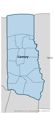
Genealogical records often identify individuals by barrio. Camuy has 13 barrios:
Daughter Municipalities
The following municipalities separated from Camuy. Residents recorded events before their founding year in Camuy's parish:
Neighboring Municipalities
Also check records in neighboring municipalities:
Historical Maps
Historical maps help identify barrios, boundaries, and communities as they existed in the past. Maps from the 18th and 19th centuries are preferred.
Camuy (2026)
Genealogy Toolkit
Diocesan Archive
Diocese: Diocese of Arecibo
For sacramental records not available digitally, contact the diocesan archive directly.
Diocese WebsiteDigital Archives
- FamilySearch: Camuy Civil and parish records
- Camuy Church Records 1836–1849 — Hijos de Coamo PR Church Records Index Indexed baptismal, marriage, and burial records for Camuy from 1836 to 1849, compiled by Hijos de Coamo PR. One of the earliest verified record sets for the parish.
- Civil Registry (Registros civiles, 1836–1994) — FamilySearch Catalog Civil Records FamilySearch Catalog entry for Camuy civil registers, including births, marriages, deaths, and indexes spanning 1836–1994.
- Puerto Rico, Catholic Church Records, 1645–1969 — FamilySearch Church Records Island-wide FamilySearch collection for Puerto Rico Catholic church registers, including baptisms, marriages, and burials. The most comprehensive digitized church-record collection covering Camuy.
- Find a Grave: Camuy Memorial Park Cemetery Records Cemetery memorial page for Camuy Memorial Park, with burial listings, family links, and plot location information.
- Find a Grave: Cemeteries in Camuy Municipality Cemetery Records Browse page for all Find a Grave–listed cemeteries in the Camuy municipality.
- Puerto Rico Civil Registration, 1885–2001 Digitized Records Civil registration births, marriages, and deaths for all Puerto Rico municipalities including Camuy, beginning 1885.
- FamilySearch: Puerto Rico Genealogy Complete records guide
Further Reading
- U.S. Census Bureau: Camuy Municipio Profile — U.S. Census Bureau Census Data Authoritative 2020 Census profile for Camuy, including official barrio list, population data, and geographic boundary information.
- Camuy, Puerto Rico Genealogy — FamilySearch Wiki — FamilySearch Research Guide FamilySearch research guide for Camuy with links to available record sets, research tips, and guidance on contacting local repositories for pre-1876 records.
- Municipio de Camuy — EnciclopediaPR — Fundación Puertorriqueña de las Humanidades Encyclopedia Authoritative institutional article covering Camuy's founding, barrios, coat of arms symbolism, geographic boundaries, and historical context.
- CAMUY — LexJuris — LexJuris de Puerto Rico Municipal History Spanish-language municipal history profile for Camuy, including founding narrative and corroborating description of the coat of arms symbolism.
Found an error or have additional information? Contact us