Cayey
Historical Overview
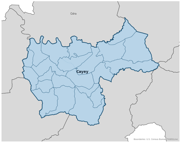
Founded on August 17, 1773, Cayey, known as the 'Ciudad de las Brumas' (City of the Mists), was established when residents of Coamo's vast highland territory petitioned for their own parish and municipal administration. Perched in the Central Mountain Range, it served as a vital crossroads between the southern coast and the northern plains, and its parish, Nuestra Señora de la Asunción, has preserved records since 1774. Cayey later served as the mother town for Cidra (1809), and its records are the primary research hub for families tracing central-southern mountain lineages back to the 18th century.
Coat of Arms

Image: Wikimedia Commons (CC BY-SA 4.0)
The shield features green mountains representing the Central Mountain Range and the town's high elevation; red roses honoring the patroness Nuestra Señora de la Asunción; a lamb symbolizing ties to the broader Christian heritage of the island; green for the fertile misty lands and gold for its historical richness.
Barrios
Genealogical records often identify individuals by barrio. Cayey has 21 barrios:
Daughter Municipalities
The following municipalities separated from Cayey. Residents recorded events before their founding year in Cayey's parish:
Neighboring Municipalities
Also check records in neighboring municipalities:
Historical Maps
Historical maps help identify barrios, boundaries, and communities as they existed in the past. Maps from the 18th and 19th centuries are preferred.
Cayey (2026)
Genealogy Toolkit
Diocesan Archive
Diocese: Diocese of Caguas
For sacramental records not available digitally, contact the diocesan archive directly.
Diocese WebsiteDigital Archives
- FamilySearch: Cayey Civil and parish records
- ADNPR: Archivo Digital Nacional de Puerto Rico Digital Archive Digital repository for 19th-century municipal documents, tax records, and property maps for the Cayey district; most reliable current source for pre-civil-registration administrative records.
- Find A Grave: Cayey Cemetery Records Burial records for the Cementerio Municipal de Cayey and local burial sites; useful for verifying death dates and family plots from the 19th and early 20th centuries.
- Puerto Rico, Catholic Church Records, 1645–1969 Digitized Records Islandwide Catholic church-record collection including baptisms, marriages, burials, and confirmations. Includes Cayey parish records.
- Puerto Rico Civil Registration, 1885–2001 Digitized Records Civil registration births, marriages, and deaths for all Puerto Rico municipalities including Cayey, beginning 1885.
- FamilySearch: Puerto Rico Genealogy Complete records guide
Further Reading
- U.S. Census Bureau: Cayey Municipio Profile — U.S. Census Bureau Census Data Authoritative 2020 Census profile for Cayey, including official barrio list, population data, and geographic boundary information.
- Notas para su Historia: Cayey — Mario A. Rodríguez León, O.P. Local History Essential historical text for Cayey covering the founding families and social development of the town, tracing the formation of the Hato de Cayey as it separated from Coamo's jurisdiction in 1773.
- Genus Meridiem: Cayey Genealogy Posts — César A. Zapata Lozada Genealogy Blog Genealogical research posts about Cayey families by Puerto Rican researcher César A. Zapata Lozada on the Genus Meridiem blog. Useful for family connections, archival discoveries, and local research leads.
GenealogíaPR.com Transcriptions
The following links connect to free church record transcription resources available through GenealogíaPR.com, the website of the Sociedad Puertorriqueña de Genealogía. These valuable resources were created and shared through the dedicated work of Sociedad members.
- Cayey: Church Record Transcriptions Sociedad Puertorriqueña de Genealogía
If these transcriptions help advance your Puerto Rican genealogy research, please consider supporting this important work by becoming a member of the Sociedad Puertorriqueña de Genealogía: Join here.
Found an error or have additional information? Contact us