Manatí
Historical Overview
Manatí, founded on June 29, 1738, as the ninth municipality established by the Spanish Crown, grew from territory that had been under Arecibo's jurisdiction since 1616. The area's fertile alluvial plains and Northern Karst topography drove an economic arc from early gold panning along the Río Grande de Manatí to large-scale sugar and pineapple production by the mid-19th century. Nicknamed 'La Atenas de Puerto Rico' for its vibrant intellectual life, Manatí also served as mother town to Ciales (1820) and Barceloneta (1881), making its parish records at Nuestra Señora de la Candelaria y San Matías essential for tracing ancestors from those municipalities before their founding dates.
Coat of Arms

Image: Wikimedia Commons (CC BY-SA 4.0)
A divided shield with four quarters and a central escutcheon. The first and fourth quarters display Greek temples representing the town's nickname 'Atenas de Puerto Rico,' honoring its 19th-century intellectual and cultural heritage. The second and third quarters feature manatees as a heraldic reference to the municipality's name. The central escutcheon bears flames honoring the Fiestas Patronales of the Virgin of Candelaria. The shield is surmounted by a three-towered mural crown, denoting the municipality's city status.
Barrios
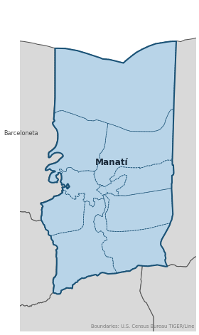
Genealogical records often identify individuals by barrio. Manatí has 9 barrios:
Daughter Municipalities
The following municipalities separated from Manatí. Residents recorded events before their founding year in Manatí's parish:
Neighboring Municipalities
Also check records in neighboring municipalities:
Historical Maps
Historical maps help identify barrios, boundaries, and communities as they existed in the past. Maps from the 18th and 19th centuries are preferred.
Manatí (2026)
Genealogy Toolkit
Parish Records
Parish: Nuestra Señora de la Candelaria y San Matías
Records from 1758
⬇ Search Catholic RecordsDiocesan Archive
Diocese: Diocese of Arecibo
For sacramental records not available digitally, contact the diocesan archive directly.
Diocese WebsiteDigital Archives
- FamilySearch: Manatí Civil and parish records
- Registros parroquiales, 1758–1939 Church Records Digitized parish registers including baptisms (from 1761), marriages (from 1758), burials (from 1784), and confirmations (from 1785) for Manatí.
- Puerto Rico, Catholic Church Records, 1645–1969 Digitized Records Islandwide Catholic church-record collection including baptisms, marriages, burials, and confirmations. Includes Manatí parish records.
- Puerto Rico Civil Registration, 1885–2001 Digitized Records Civil registration births, marriages, and deaths for all Puerto Rico municipalities including Manatí, beginning 1885.
- FamilySearch: Puerto Rico Genealogy Complete records guide
Further Reading
- U.S. Census Bureau: Manatí Municipio Profile — U.S. Census Bureau Census Data Authoritative 2020 Census profile for Manatí, including official barrio list, population data, and geographic boundary information.
- FamilySearch Wiki: Manatí Genealogy — FamilySearch Research Guide Centralized research portal listing all available record collections for Manatí, including links to digitized parish registers, civil records, and census materials.
- Registros civiles, 1885–1998 — Registro Civil de Manatí Civil Registration Civil registration of births (1885–1928), marriages (1885–1936), and deaths (1885–1998) for Manatí.
- Documentos municipales de Manatí, 1845–1867 — Municipio de Manatí Municipal Records 19th-century municipal records including the Censo de Jornaleros (day laborer census), listing laborers by name, age, barrio, and hacienda employer.
- Cédulas de vecindad y padrones de población, 1850–1876 — Municipio de Manatí Identification Records Residency identification cards listing name, age, marital status, and often physical description — essential for tracking migrants to Manatí.
Found an error or have additional information? Contact us