Morovis
Historical Overview
Morovis is a municipality in the central highlands of Puerto Rico, officially established January 24, 1818 after residents petitioned for separation from Manatí due to distance and poor roads. The town is celebrated as the primary center of production of the cuatro, Puerto Rico's traditional string instrument, a tradition honored in the municipal coat of arms. For genealogical research, records before 1818 should be traced through Manatí, as Morovis families were registered there prior to separation; the Parroquia Nuestra Señora del Carmen, whose church building was completed in 1823, holds the earliest local parish registers. Civil registration begins in 1885.
Coat of Arms

Image: Wikimedia Commons (CC BY-SA 4.0)
The Morovis coat of arms is divided into three sections: a gold left field bearing a sable eagle with red beak and claws, its head encircled by a halo, representing Saint John the Evangelist and honoring the town's principal founder Don Juan Evangelista Rivera; a red right field bearing five cuatros (the traditional Puerto Rican string instrument), honoring Morovis as the principal center of cuatro production on the island; and a center emblem of the Order of Carmelite Nuns, honoring the patron saint Nuestra Señora del Carmen. A three-towered castle crowns the top, marking municipal status.
Barrios
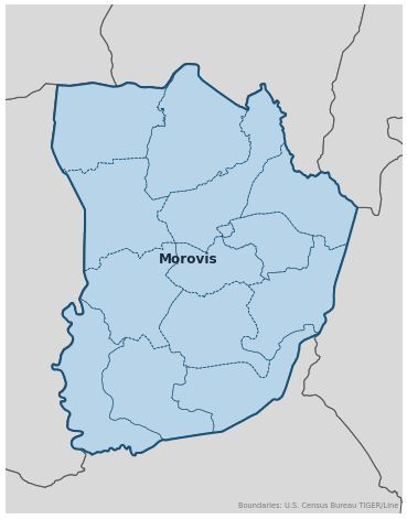
Genealogical records often identify individuals by barrio. Morovis has 14 barrios:
Neighboring Municipalities
Also check records in neighboring municipalities:
Historical Maps
Historical maps help identify barrios, boundaries, and communities as they existed in the past. Maps from the 18th and 19th centuries are preferred.
Morovis (2026)
Genealogy Toolkit
Diocesan Archive
Diocese: Diocese of Arecibo
For sacramental records not available digitally, contact the diocesan archive directly.
Diocese WebsiteDigital Archives
- FamilySearch: Morovis Civil and parish records
- Puerto Rico, Catholic Church Records, 1645–1969 Parish Records FamilySearch digitized Catholic Church records for Puerto Rico, including Morovis parish registers from the Parroquia Nuestra Señora del Carmen.
- Puerto Rico Civil Registration, 1885–2001 Digitized Records Civil registration births, marriages, and deaths for all Puerto Rico municipalities including Morovis, beginning 1885.
- FamilySearch: Puerto Rico Genealogy Complete records guide
Further Reading
- Los primeros grupos familiares moroveños en la fundación del poblado — Dra. Raquel Rosario-Rivera Genealogy Article Article from La Revista de Genealogía Puertorriqueña (Año 4, Núm. 2, octubre 2003) documenting the founding families of Morovis, with a list of early family groups.
- Puerto Rico, Civil Registrations, 1885–2001 — FamilySearch Civil Registration FamilySearch collection for Puerto Rico civil registration records, including birth, marriage, and death records for Morovis from 1885 onward.
Found an error or have additional information? Contact us