Maricao
Historical Overview
Maricao is a mountain municipality in western Puerto Rico, located in the Cordillera Central. Residents petitioned for Maricao and its barrios to separate from San Germán in the early 1870s, and the town was founded and made official in 1874. For genealogical research, families before the 1860s–1870s should be traced through San Germán parish and municipal records, as the Parroquia San Juan Bautista emerged from San Germán de Auxerre around 1864. Maricao lies in Puerto Rico's historic coffee-growing zone, and civil registration begins in 1885.
Coat of Arms

Image: Wikimedia Commons (CC BY-SA 4.0)
The Maricao coat of arms is divided into three sections: white upper and lower sections with flowering branches of the maricao tree, referring to the town name; a green central chevron with five bohíos symbolizing the Taíno population of the region; coffee branches around the shield representing the municipality's place in Puerto Rico's coffee-growing zone; and a mural crown marking municipal status.
Barrios
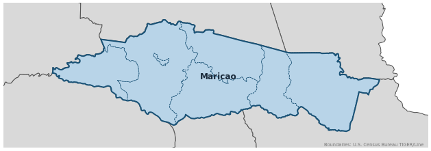
Genealogical records often identify individuals by barrio. Maricao has 7 barrios:
Neighboring Municipalities
Also check records in neighboring municipalities:
Historical Maps
Historical maps help identify barrios, boundaries, and communities as they existed in the past. Maps from the 18th and 19th centuries are preferred.
Maricao (2026)
Genealogy Toolkit
Diocesan Archive
Diocese: Diocese of Mayagüez
For sacramental records not available digitally, contact the diocesan archive directly.
Diocese WebsiteDigital Archives
- FamilySearch: Maricao Civil and parish records
- Puerto Rico, Catholic Church Records, 1645–1969 Digitized Records Islandwide Catholic church-record collection including baptisms, marriages, burials, and confirmations. Includes Maricao parish records.
- Puerto Rico Civil Registration, 1885–2001 Digitized Records Civil registration births, marriages, and deaths for all Puerto Rico municipalities including Maricao, beginning 1885.
- FamilySearch: Puerto Rico Genealogy Complete records guide
Further Reading
- Registros civiles, 1885–1983, Maricao — FamilySearch Digital Collection FamilySearch catalog record for Maricao civil registration, including births, marriages, and deaths from 1885.
- Puerto Rico Civil Registration, 1805–2002 — FamilySearch Digital Collection Searchable collection of Puerto Rico civil records including Maricao.
- Puerto Rico Catholic Church Records, 1645–2021 — FamilySearch Digital Collection General Puerto Rico Catholic collection including baptisms, confirmations, marriages, deaths, and parish censuses.
- Notas para su Historia — Maricao — Oficina Estatal de Conservación Histórica Local History Local history of Maricao in the Notas para su Historia series.
- EnciclopediaPR — Municipio de Maricao — EnciclopediaPR Reference Overview of Maricao history, geography, coat of arms, and municipal context.
Found an error or have additional information? Contact us