Coamo
Historical Overview
Coamo, known as the 'Villa de San Blas de Illescas' and the 'City of the Center of the Universe,' is the third oldest town in Puerto Rico, founded in 1579. Located in the south-central region between the Cordillera Central and the Caribbean coastal plain, it served for centuries as the primary administrative and religious hub for the surrounding region. The Parroquia San Blas de Illescas holds sacramental records beginning in 1701, making it one of the earliest surviving parish record sets on the island and essential for tracing families across south-central Puerto Rico. Coamo was a significant pueblo matriz: Juana Díaz separated in 1798, Barranquitas in 1803, Aibonito in 1824, and Salinas in 1841. Researchers tracing ancestors in those municipalities before their founding dates must search Coamo church and civil records. Civil registration began in 1885. The municipality is also known for the Baños de Coamo thermal springs, documented since the Spanish period.
Coat of Arms

Image: Wikimedia Commons (CC BY-SA 4.0)
Divided into four quarters: the top left shows an episcopal miter on a red field, representing the patron saint San Blas; the top right shows two gold bells on a red field, symbolizing the original parish and the calling of the faithful; the bottom left shows two gold flames on a red field, representing the famous thermal springs (Los Baños de Coamo); the bottom right shows a golden cross-crowned orb (globus cruciger) on a red field, representing the town's historic Villa status and historical jurisdiction. Topped by a three-towered mural crown signifying its status as a town.
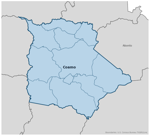
Barrios
Genealogical records often identify individuals by barrio. Coamo has 11 barrios:
Daughter Municipalities
The following municipalities separated from Coamo. Residents recorded events before their founding year in Coamo's parish:
- Guayama (founded 1736) — San Antonio de Padua
- Cayey (founded 1773) — Nuestra Señora de la Asunción
- Barranquitas (founded 1803) — San Antonio de Padua
- Adjuntas (founded 1815) — San Joaquín y Santa Ana
- Salinas (founded 1820) — Nuestra Señora de la Monserrate
- Aibonito (founded 1824) — San José
- Orocovis (founded 1825) — San Juan Bautista de Barros
- Santa Isabel (founded 1842) — Santiago Apóstol
Neighboring Municipalities
Also check records in neighboring municipalities:
Historical Maps
Historical maps help identify barrios, boundaries, and communities as they existed in the past. Maps from the 18th and 19th centuries are preferred.
Coamo (2026)
Genealogy Toolkit
Diocesan Archive
Diocese: Diocese of Ponce
For sacramental records not available digitally, contact the diocesan archive directly.
Diocese WebsiteDigital Archives
- FamilySearch: Coamo Civil and parish records
- Find A Grave: Cementerio Municipal Civil de Coamo Cemetery index
- Notas para su Historia: Coamo (OECH) Government History (PDF) Historical reference PDF covering Coamo's founding, geographic history, and cultural heritage, published by the Office of Historic Preservation of Puerto Rico.
- Puerto Rico, Catholic Church Records, 1645–1969 Digitized Records Islandwide Catholic church-record collection including baptisms, marriages, burials, and confirmations. Includes Coamo parish records.
- Puerto Rico Civil Registration, 1885–2001 Digitized Records Civil registration births, marriages, and deaths for all Puerto Rico municipalities including Coamo, beginning 1885.
- FamilySearch: Puerto Rico Genealogy Complete records guide
Further Reading
- Historia de Coamo: La Villa Añeja — Rivera Bermúdez, Ramón Book The definitive historical text for Coamo settlers and local development. Coamo, Puerto Rico: Imprenta Coamo, 1980.
- Las encarnaciones de un pueblo: San Blas de Illescas de Coamo — Dávila, Arturo V. Book San Juan: Instituto de Cultura Puertorriqueña, 1979.
- BoricuaGenes: San Blas de Illescas Church Index — Coamo — BoricuaGenes Index Index to San Blas de Illescas Church records for Coamo on FamilySearch.org, covering deaths (defunciones), marriages (matrimonios), baptisms (bautismos), and confirmations (confirmaciones). A useful finding aid to navigate the parish record sets before searching the images.
GenealogíaPR.com Transcriptions
The following links connect to free church record transcription resources available through GenealogíaPR.com, the website of the Sociedad Puertorriqueña de Genealogía. These valuable resources were created and shared through the dedicated work of Sociedad members.
- Coamo: Church Record Transcriptions Sociedad Puertorriqueña de Genealogía
If these transcriptions help advance your Puerto Rican genealogy research, please consider supporting this important work by becoming a member of the Sociedad Puertorriqueña de Genealogía: Join here.
Found an error or have additional information? Contact us