Vega Baja
Historia
Conocida como la Ciudad del Melao Melao, Vega Baja es un municipio costero en la llanura norte de Puerto Rico que tiene sus raíces en el asentamiento original de la Vega de la Ribera del Sibuco; fue formalmente constituido en 1776 tras la separación de Vega Alta en 1775. Su historia está profundamente marcada por la agricultura de la caña de azúcar, que impulsó tanto el desarrollo económico como el movimiento de trabajadores esclavizados cuyos descendientes son objeto de investigación hoy en día. La parroquia católica principal, Nuestra Señora del Rosario, conserva registros de bautismos, matrimonios y entierros desde 1779, situando a Vega Baja entre los municipios mejor documentados para la genealogía del período colonial tardío en la costa norte. Los investigadores que rastrean linajes afropuertorriqueños también deben consultar el Registro Central de Esclavos de 1872, disponible en FamilySearch.
Escudo de Armas

Imagen: Wikimedia Commons (CC BY-SA 4.0)
El escudo de Vega Baja presenta una banda en forma de V que representa la llanura fértil y la inicial del nombre del pueblo; flores de azahar que recuerdan el nombre original del asentamiento 'Vega-Baxa del Naranjal' (llanura del naranjal); cañas de azúcar que simbolizan la importancia histórica de la industria azucarera y el melao de producción local; y una corona mural de tres torres que significa su estatus como municipio.
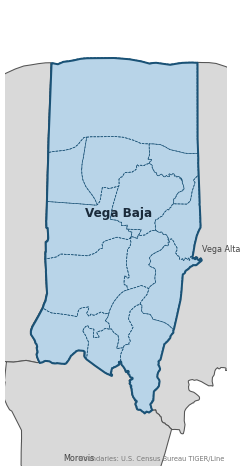
Barrios
Los registros genealógicos a menudo identifican al individuo por su barrio. Vega Baja tiene 14 barrios:
Municipios Hijos
Los siguientes municipios se separaron de Vega Baja. Los habitantes registraban eventos antes de la fecha de fundación en la parroquia de Vega Baja:
Municipios Vecinos
Revise también los registros de los municipios vecinos:
Mapas Históricos
Los mapas históricos ayudan a identificar barrios, límites y comunidades tal como existían en el pasado. Se prefieren mapas de los siglos XVIII y XIX.
Vega-baja (2026)
Recursos de Genealogía
Registro Civil
Comenzaron en 1885
Cubre nacimientos, matrimonios y defunciones.
⬇ Buscar Registros CivilesRegistros Parroquiales
Parroquia: Nuestra Señora del Rosario
Registros desde 1779
⬇ Buscar Registros CatólicosArchivo Diocesano
Diócesis: Diócesis de Arecibo
Para registros sacramentales que no están disponibles digitalmente, contacta directamente el archivo diocesano.
Sitio de la DiócesisArchivos Digitales
- FamilySearch: Vega Baja Registros civiles y parroquiales
- Find A Grave: Cementerio Municipal Viejo Histórico de Vega Baja Registros de cementerio Índice de cementerios del histórico Cementerio Municipal de Vega Baja, que contiene registros de entierro de familias locales del siglo XIX y principios del XX.
- Puerto Rico, Catholic Church Records, 1645–1969 Registros digitalizados Colección de registros de la iglesia católica de toda la isla, incluidos bautismos, matrimonios, entierros y confirmaciones. Incluye registros parroquiales de Vega Baja.
- Puerto Rico Civil Registration, 1885–2001 Registros digitalizados Registro civil de nacimientos, matrimonios y defunciones para todos los municipios de Puerto Rico incluyendo Vega Baja, a partir de 1885.
- Another Look at My Vega Baja Roots Genealogy Blog Publicación de investigación genealógica personal sobre raíces de Vega Baja por Luis Rivera en el blog Boricua Genes. Útil para conexiones familiares y pistas de investigación local.
- FamilySearch: Genealogía de Puerto Rico Guía completa de registros
Lecturas Recomendadas
- U.S. Census Bureau: Vega Baja Municipio Profile — U.S. Census Bureau Datos del censo Perfil autorizado del censo 2020 para Vega Baja, que incluye lista oficial de barrios, datos de población e información de límites geográficos.
- Vega Baja: Notas para su Historia — Luis de la Rosa Martínez Historia local Historia completa de Vega Baja (1986) que proporciona un contexto crucial sobre las primeras concesiones de tierras, las familias fundadoras y el desarrollo socioeconómico de la ciudad, la referencia definitiva para la investigación genealógica en el municipio.
- FamilySearch Catalog: Vega Baja — Parroquia Nuestra Señora del Rosario — FamilySearch Guía de investigación Entrada del catálogo de FamilySearch para Nuestra Señora del Rosario, que cubre registros parroquiales católicos (bautismos de 1779, matrimonios de 1791, entierros de 1779) y registros civiles de 1885, con enlaces directos a colecciones digitalizadas.
- Registro Central de Esclavos de 1872 — Puerto Rico — FamilySearch Registros de esclavitud El Registro Central de Esclavos de 1872 para Puerto Rico, incluidas las entradas de Vega Baja. Imprescindible para investigadores que rastreen linajes afropuertorriqueños en el municipio.
¿Encontró un error o tiene información adicional? Contáctenos